Boyd Tavern
*National Register of Historic Places
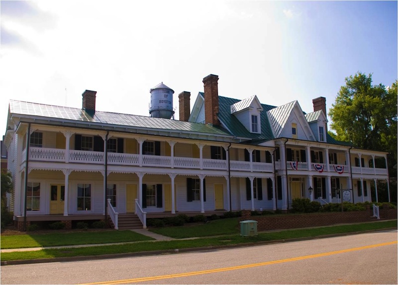
449 Washington St. Boydton, Virginia 23917
(434) 738-9300
Hours:
Wed - Fri, 11 a.m. to 4 p.m.; or call for appointment
(hours subject to change)
Fees: Yes
The Boyd Tavern is one of few structures, if not the only structure, surviving within the town limits of Boydton that actually predates the town, which was established in 1812. In 1765, the newly formed Mecklenburg County granted Richard Swepson, Sr. a license to operate an ordinary. Swepson's ordinary is the earliest record of what would become the Boyd Tavern of Boydton.
(434) 738-9300
Hours:
Wed - Fri, 11 a.m. to 4 p.m.; or call for appointment
(hours subject to change)
Fees: Yes
(Read More, View Additional Photos)
Buffalo Lithia Springs
*National Register of Historic Places
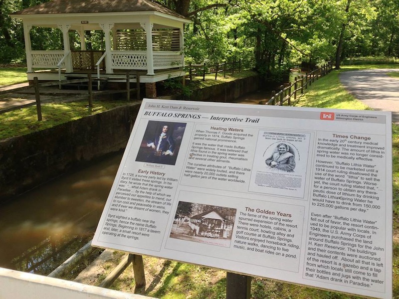
99 Buffalo Springs Road, Buffalo Junction, VA
(434) 738-6143 (John H. Kerr Dam and Reservoir Visitor Assistance Center)
Hours:
Dawn to Dusk
(gate not locked)
Fees: No
The Buffalo Lithia Springs were first brought to the attention of Colonel William Byrd by Native Americans in 1726 while he was surveying the boundary between Virginia and Carolina. Byrd called the site "Buffalo Springs", because when they arrived, they killed a local buffalo for food, which was drinking from one of the springs. (434) 738-6143 (John H. Kerr Dam and Reservoir Visitor Assistance Center)
Hours:
Dawn to Dusk
(gate not locked)
Fees: No
(Read More, View Additional Photos)
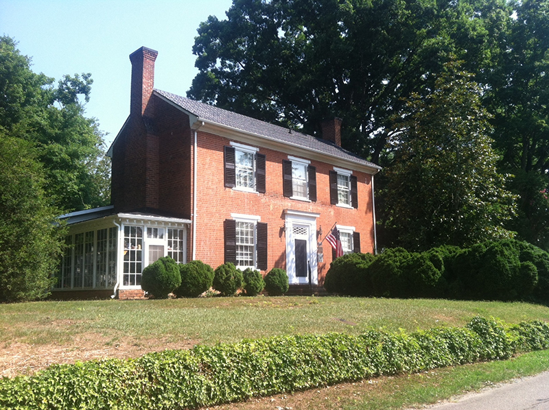
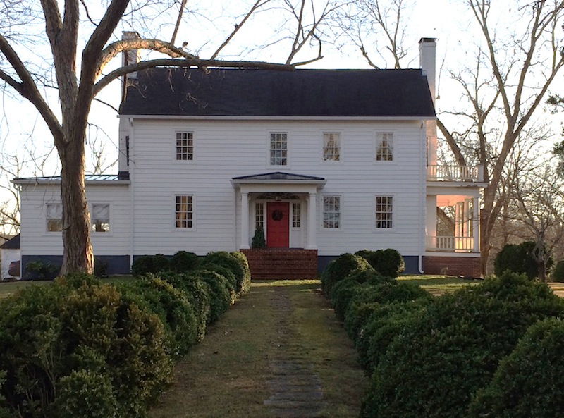
Cedar Crest
*National Register of Historic Places—Boydton Historic District
1571 Jefferson Street, Boydton, VA 23917
Hours:
Private home, not open to the public
Fees: not open to the public
William Osborne Goode, son of John Chesterfield Goode, built Cedar Crest in 1821. William Goode, a College of William and Mary graduate, was licensed to practice law in Mecklenburg in 1821. He served as state and national representative. His political career began in 1822 when he was elected to the Virginia House of Delegates. He died in 1859 while serving in the United States Congress. Hours:
Private home, not open to the public
Fees: not open to the public
(Read More, View Additional Photos)
Clark Royster House & Clarksville
*National Register of Historic Places
300 Rose Hill Ave,
Clarksville, VA 23927
Hours:
Private, not open to the public
Fees: not open to the public
In September 1792 William Royster deeded his son, Clark, 376 acres in two tracts for "love and affection" and five shillings. [MCDB 8:161] On portions of this property Clark made his home, built several businesses and established the Town of Clarksville.
Hours:
Private, not open to the public
Fees: not open to the public
(Read More, View Additional Photos)
Elm Hill
*National Register of Historic Places
Dick Cross WMA
Location: House remains are located on property adjacent to the Dick Cross Wildlife Management Area (WMA). The WMA entrance is on the east side of Buggs Island Road (Route 4) adjacent to Pino's Pizza (6288 Buggs Island Rd.) House site is surrounded by state-owned Wildlife Management Area (WMA).
Hours:
Dawn to Dusk
Fees/Access: Access care of Dick Cross Wildlife Management Area. Permits and fees apply for visitors to DGIF-owned (WMAs) who are age 17 and older, unless they possess a valid Virginia hunting, freshwater fishing, or trapping license, or a current Virginia boat registration.
This house burned June 25, 2014, the result of a lightning strike.
For over 200 years, on the north bank of the Roanoke River, with a commanding view of a bend in the river, stood the house known as Elm Hill. Historical explanations of the chain of ownership of the land and the origin of the house are often conflicting but apparently the house was built in the late 18th century. At various times in the 18th century it was home to Sir Peyton Skipwith, baronet, and his family.
(Read More, View Additional Photos)
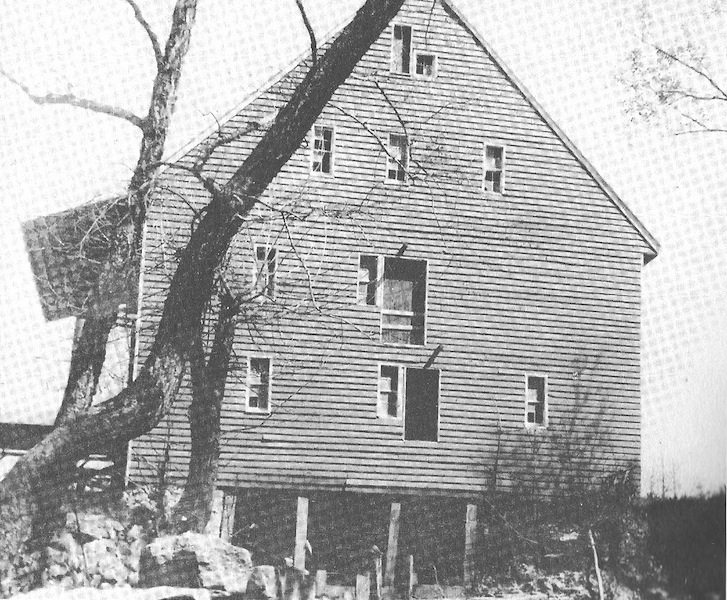
Horseford Mill (a.k.a. Boyd's Mill)
Near intersection of Highway 903 and Fawn Lane, Bracey, VA 23919
Hours:
Private property; demolished (actually underwater)
Building demolished circa 1960s; site, now underwater, was generally near the current Buckhead Subdivision boat ramp (private).
Hours:
Private property; demolished (actually underwater)
The Horseford Mill (later referred to as Boyd's Mill) stood at the north bank of the Roanoke River, at the "horse ford." The four-story wooden mill, and the land, belonged to Armstead Goode Boyd, who also ran a nearby country store. The mill gave local citizens on the homefront the security of a known and nearby place to continue to get flour ground.
(Read More)
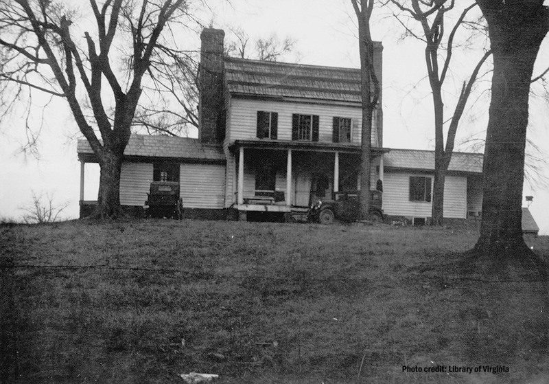
Horseford Plantation

Near intersection of Highway 903 and St. Tammany Drive. Partially viewable from Anchorage Way, Bracey, VA 23919
Hours:
Private home, not open to the public
Planter, merchant, entrepreneur, and local business advisor Armstead Goode Boyd lived at Horseford Plantation, which took its name from the ford on the Roanoke River: the horse ford. The present house ("Isle of Rest") was built for Boyd in 1868 to replace the house, destroyed by fire, that he and his family lived in during the Civil War.
Hours:
Private home, not open to the public
(Read More)
Hugh Garland House
*National Register of Historic Places - Boydton Historic District
1550 Jefferson Street, Boydton, Virginia 23917
Hours:
Private home, not open to the public; please respect the homeowners' privacy with driveways, etc.
Prior to the war Elizabeth (Lizzy) Hobbs, who would eventually become seamstress and confidante to Mrs. Abraham Lincoln, lived briefly in Boydton as a slave of the Armistead Burwell family. Armistead Burwell (1777-1841) moved his family from Hampden Sydney College, where he had been employed as steward, to Boydton in 1830. However, in a practice common in the slave-holding society, Lizzy as she was known, was "loaned" to Armistead's oldest son, Robert, in 1832, and she was moved out of Mecklenburg County to Hillsborough, North Carolina for what she described as ten unhappy years. About 1842 she was returned to Virginia, and eventually she was relegated to Armistead's daughter, Anne, and her husband, Hugh Garland, with whom she was by her own account happiest at least during her slavery years. She was moved with the family to St. Louis, Missouri in about 1847 where she honed her dressmaking skills while actually supporting the Burwell family, and bought her freedom in 1855. She married while in St. Louis, becoming Mrs. Elizabeth H. Keckly.
Hours:
Private home, not open to the public; please respect the homeowners' privacy with driveways, etc.
(Read More)
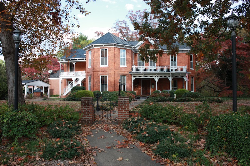
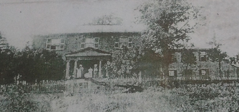
Judge Henry Wood, Jr. Home
*National Register of Historic Places
105 6th Street, Clarksville, VA 23927
Hours:
Private home, not open to the public
The center section of the two story brick Queen Anne home was originally built around 1829 and the front of the home faced south towards Virginia Avenue. The Wood family bought the home in 1872 and added the south wing in the 1880's essentially as you see it today.
Hours:
Private home, not open to the public
(Read More, View Additional Photos)
Lockett's Foundry & Jones Mill
*National Register of Historic Places
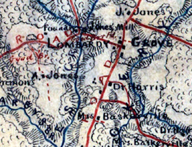
Nothing remains of either structure. They were located near the intersection of Union Level Road and Gordon's Lake Road, South Hill, VA, and in the vicinity of the Virginia Department of Game & Inland Fisheries Lake Gordon Public Boat Access on Route 799 just off Union Level Road (S.R. 664).449 Washington St. Boydton, Virginia 23917
In the nineteenth century a foundry, mill and store were located near the Lombardy Grove Tavern and under the same ownership--the William Jones family from 1828 to 1869 and Harwood A. Lockett from 1869 to 1892.
(Read More)
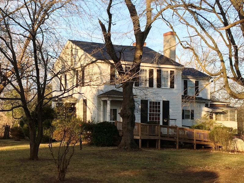
Logsdale (Hendrick Plantation)
2444 Palmer Springs Road, Boydton, VA 23917
Hours:
Private home, not open to the public
Logsdale was built by Revolutionary War General Samuel Hopkins, Jr. about 1783. The plantation was eventually sold to the heirs of William Hendrick and subsequently also known as the Buck Hendrick Plantation.
Hours:
Private home, not open to the public
(Read More, View Additional Photos)
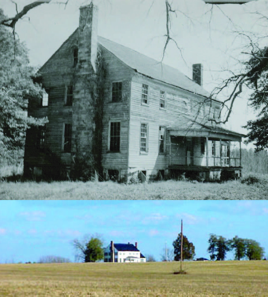
Lombardy Grove Tavern
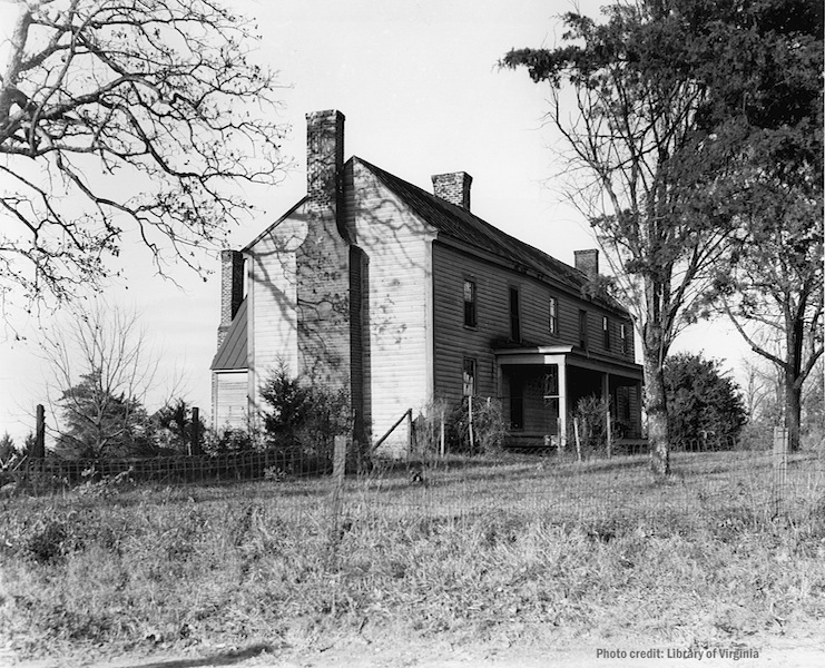
4764 Plank Rd. (approximate), South Hill, VA; Near intersection of Union Level Road and Plank Road, South Hill, VA
Hours:
Private property, not open to the public
The community of Lombardy Grove appears on Madison's Map of Virginia dated 1818 and may have originated around the extensive plantation of that name, belonging to William Baskervill, Senior, clerk of court for Mecklenburg County, 1784-1814. His operation, which was about one mile south of Union Level Road, included a tannery, blacksmith shop, an ordinary, and a log store that also housed a post office established in 1807. Advertisements, maps, letters, and diaries indicate that Lombardy Grove was a busy community in the nineteenth century prominently located on major thoroughfares of the nineteenth century.
Hours:
Private property, not open to the public
(Read More, View Additional Photos)
MacCallum More Museum & Gardens
Remains of Stoneland Plantation & nearby Civil War Trails marker for Christiansville at Butler Memorial Library
*National Register of Historic Places
Remains of Stoneland Plantation & nearby Civil War Trails marker for Christiansville at Butler Memorial Library
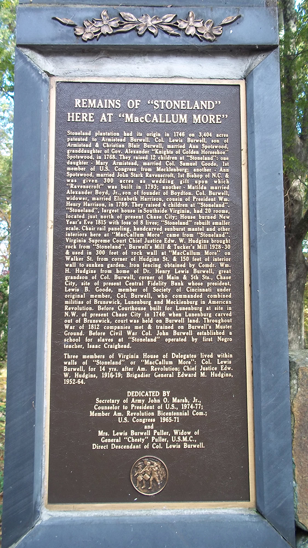
603 Hudgins St., Chase City, VA 23924
(434) 372-0502
Hours:
Monday - Friday: 10:00 am - 5:00 pm
Saturday: 10:00 am - 1:00 pm
Sunday: Closed
Major Holidays: Closed (unless otherwise posted)
Gardens open Daily for self-guided tour.
Fees: Yes. Please contact the MacCallum More office for admission fees, event information, rental information, meetings, educational classes, and group tours. Gardens will be closed for private functions and weddings. The Civil War Trails marker for Christiansville is located at the nearby Butler Memorial Library, 515 N. Marshall Street, Chase City.
In the heart of Chase City are approximately six acres of formal gardens, fountains, and beautiful statuary, including a 1st-century Roman bust, nestled in a woodland setting among 8,000 boxwoods--many from old homes in Southside Virginia, native dogwoods, and azaleas.
(434) 372-0502
Hours:
Monday - Friday: 10:00 am - 5:00 pm
Saturday: 10:00 am - 1:00 pm
Sunday: Closed
Major Holidays: Closed (unless otherwise posted)
Gardens open Daily for self-guided tour.
Fees: Yes. Please contact the MacCallum More office for admission fees, event information, rental information, meetings, educational classes, and group tours. Gardens will be closed for private functions and weddings. The Civil War Trails marker for Christiansville is located at the nearby Butler Memorial Library, 515 N. Marshall Street, Chase City.
(Read More, View Additional Photos)
Mecklenburg County Courthouse & Confederate Monument on Courthouse Square
*National Register of Historic Places
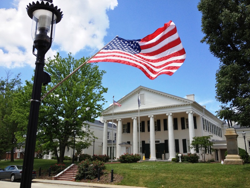
393 Washington Street, Boydton, Virginia 23917
(434) 738-6191
Clerk's Office Hours:
Monday-Friday, 8:30 AM - 5:00 PM
Mecklenburg County Courthouse is located in the heart of Boydton and currently houses the 10th Judicial Circuit of Virginia. After an extensive 10.7 million dollar renovation and expansion, it was re-dedicated with a ceremony on October 23, 2011. This Palladian courthouse was constructed between 1838 and 1842 by William A. Howard and James Whitice, using Thomas Jefferson's architectural principles. It was constructed to replace the eighteenth-century courthouse and 1815 clerk's office. Bricks from the floor and walls of the original clerk's office were used for the walkways in front of the new courthouse. Howard and Whitice constructed the two-story, six-columned building at a cost of $8,000 with local brick and built the columns out of brick, covered with stucco, replete with entasis (the application of a convex curve to a surface for aesthetic purposes), as Thomas Jefferson's builders had often done.
(434) 738-6191
Clerk's Office Hours:
Monday-Friday, 8:30 AM - 5:00 PM
(Read More, View Additional Photos)
Mount Horeb Church - Civil War Trails marker
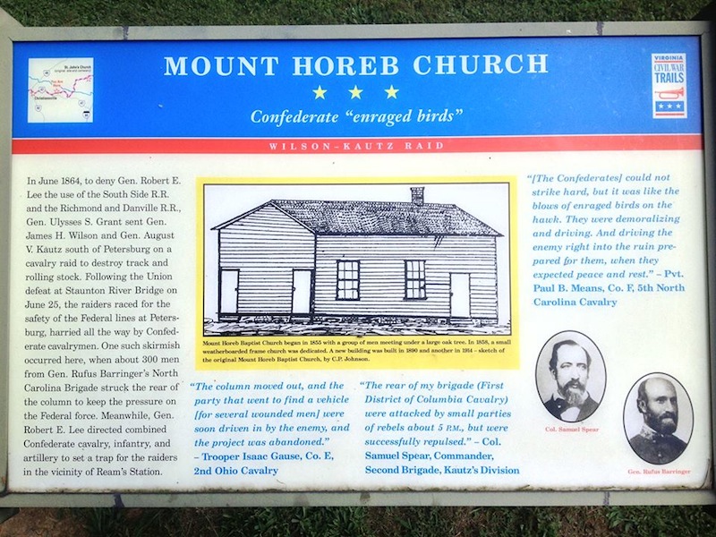
Marker is in the churchyard of modern-day Mount Horeb Baptist Church on north side of Old Cox Road, 0.1 mile east of Meadows Road, Chase City, Virginia 23924. Church address is listed as 10077 Old Cox Road.
Hours:
Cemetery and Marker Open to the Public
Fees: No
The related marker [View in Link] commemorates a skirmish site where Confederate General Rufus Barringer's North Carolina Brigade struck the rear of the Federal column.
Hours:
Cemetery and Marker Open to the Public
Fees: No
The related Civil War Trails marker includes the subtitle "Confederate 'enraged birds'" along with this description:
"In June 1864, to deny Gen. Robert E. Lee the use of the South Side R.R. and the Richmond and Danville R.R., Gen. Ulysses S. Grant sent Gen. James H. Wilson and Gen. August V. Kautz south of Petersburg on a cavalry raid to destroy track and rolling stock. Following the Union defeat at Staunton River Bridge on June 25, the raiders raced for the safety of the Federal lines at Petersburg, harried all the way by Confederate cavalrymen. One such skirmish occurred here, when about 300 men from Gen. Rufus Barringer's North Carolina Brigade struck the rear of the column to keep the pressure on the Federal force. Meanwhile, Gen. Robert E. Lee directed combined Confederate cavalry, infantry, and artillery to set a trap for the raiders in the vicinity of Ream's Station."
(Read More, View Additional Photos)
Oakley & Aegypt
Locations:
Oakley: 2181 W. Orgainsville Road, Clarksville, Va. 23927 [map]
Aegypt: 3306 Trottinridge Road, Clarksville, Va. 23927 [map]
Hours:
Private Homes, not open to the public. The owners request that passersby respect their privacy.
Robert Alexander Boyd was born in Oakley, Mecklenburg County, Virginia, in 1842, the son of Richard and Lucy Ann Goode Boyd. Robert Alexander enrolled at Randolph-Macon College in 1858, but as did many of his classmates at the onset of the war, he left school to enlist in the Confederate forces. Richard Boyd, wanting his son to enlist as an officer, promptly arranged for Robert Alexander to attend Virginia Military Institute in lieu of immediate service. After graduating from VMI in 1863, Robert joined the 1st Engineers Troop (Col. T. M. R. Talcott commanding) as the 1st Sergeant of Company D and served until the end of the war. Boyd witnessed the surrender at Appomattox Courthouse, where his unit served as bodyguard for General Lee as they stood under the apple tree awaiting the surrender arrangements.
Oakley: 2181 W. Orgainsville Road, Clarksville, Va. 23927 [map]
Aegypt: 3306 Trottinridge Road, Clarksville, Va. 23927 [map]
Hours:
Private Homes, not open to the public. The owners request that passersby respect their privacy.
(Read More, View Additional Photos)
Occoneechee State Park
and the remains of Occoneechee Plantation
and the remains of Occoneechee Plantation
1192 Occoneechee Park Road, Clarksville VA 23927
(434) 374-2210
Hours:
Open Year Round 8 a.m. to dusk
Fees: State Park fees apply
Around 1839 William Townes made his home on the Roanoke River. His plantation, which covered 3,105 acres including Occoneechee Island, became known as the Occoneechee Plantation. The plantation was named for the Indian tribe that occupied the area prior to their annihilation by Nathaniel Bacon and his followers. The tribe was principally located on the island that bore their name now located under the waters of John H. Kerr Reservoir.
(434) 374-2210
Hours:
Open Year Round 8 a.m. to dusk
Fees: State Park fees apply
(Read More, View Additional Photos)
Prestwould Plantation
*National Register of Historic Places*National Historic Landmark
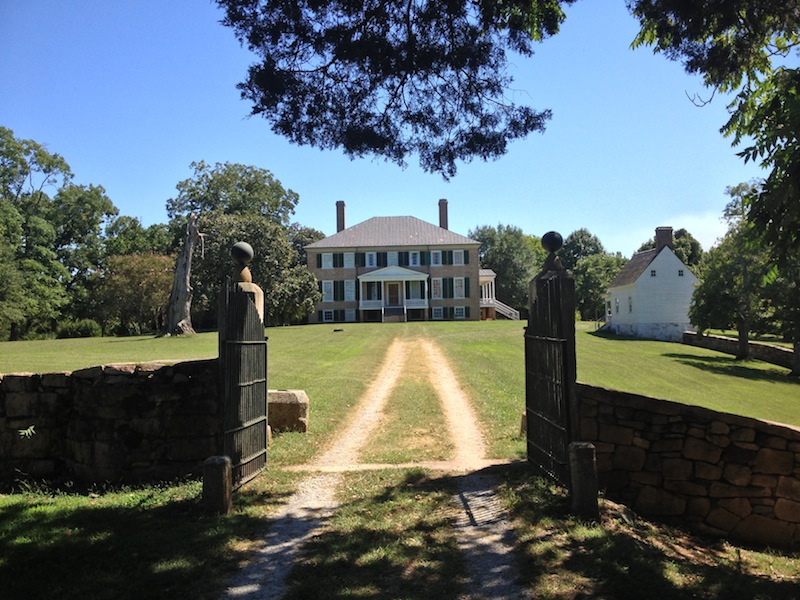
429 Prestwould Drive, Clarksville, VA 23927
(434) 374-8672
Hours:
Call for current schedule.
Fees: Yes
(434) 374-8672
Hours:
Call for current schedule.
Fees: Yes
Seat of one of the principal Cavalier families of Virginia, Prestwould was built by Sir Peyton Skipwith for himself and his second wife, Lady Jean. Sir Peyton was an American-born Baronet, third in descent from Sir Grey Skipwith, who emigrated from England to Middlesex County, Virginia during the rule of Oliver Cromwell. An avid book collector and amateur botanist, Jean Miller Skipwith, Lady Skipwith assembled one of the largest libraries owned by a Virginia woman early in the 19th century. Prestwould remained in the Skipwith family for four generations into the 20th century.
(Read More, View Additional Photos)
Randolph-Macon College / Boydton Institute Historic Site
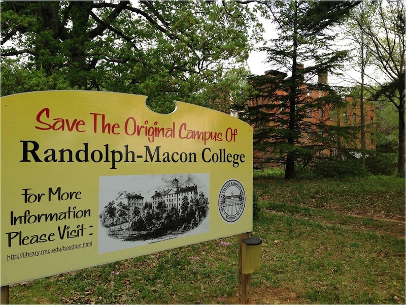
Remains of main building near intersection of Hwy. 58 and West Jefferson St. (behind Triangle Grocery); Viewable from Jefferson St., Boydton, Virginia
Other campus landmarks -- President's House, Steward's Hall and two professors' residences -- are nearby private homes.
On U.S. 58 adjacent the site are historical markers commemorating Randolph Macon College, and, the Boydton Institute as a part of the Virginia Civil Rights in Education Heritage Trail.
Other campus landmarks -- President's House, Steward's Hall and two professors' residences -- are nearby private homes.
Randolph Macon College was organized in 1830 by the Methodist denomination to respond to the need for a liberal arts college for prospective ministers, and remains the oldest incorporated Methodist College in the country.
(Read More, View Additional Photos)
Rosemont

Adjacent and viewable from Rosemont Vineyards and Winery (below)
Hours:
Private home, not open to the public.
Rosemont Vineyards and Winery:Hours:
Private home, not open to the public.
1050 Blackridge Road, La Crosse, VA 23950 [map]
434-636-WINE (9463)
Hours: Monday - Saturday: 11 am to 6 pm, Sundays: 1 pm to 6 pm
While the original structure built by the Thomas family dates back to the late eighteenth century, Rosemont was purchased by Dr. Latinus Irving Rose in 1858. A physician, Dr. Rose remained on the homefront during the war to care for those in the area, including enslaved individuals and "free negroes". Dr. Rose also traveled to Richmond to the Camp of Instruction to care for Company B, 56th Regiment (also known as The Mecklenburg Spartans) as they awaited their deployment and suffered from conditions like measles. He received $108.85 from the Regiment in November 1861 for his services, according to his Medical & Account Journal, 1858-1870.
(Read More, View Additional Photos)
Sunnyside
*National Register of Historic PlacesSunnyside is now operating as a restaurant.
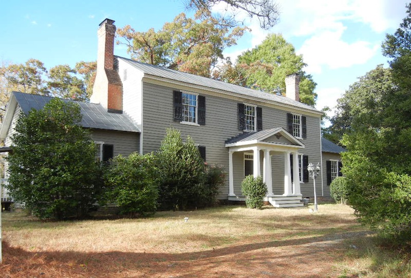
104 Shiney Rock Road, Clarksville, Virginia
(434) 374-4200
Hours: Open for lunch and dinner Tuesday through Friday, and Sunday brunch.
Call for exact hours.
Sunnyside is an estate, including a multi-sectional plantation house, the earliest part of which was built in 1833 for Samuel Hester and Eliza Greenwood Hester, on property inherited from her father. A 1936 Sunnyside survey report, part of the Virginia W.P.A. Historical Inventory Project, indicates, however, that "the back of the house was originally an old inn in Revolutionary days" and that "the old turnpike road went past the well and the stage-coaches used to stop there to water their horses".
(434) 374-4200
Hours: Open for lunch and dinner Tuesday through Friday, and Sunday brunch.
Call for exact hours.
(Read More, View Additional Photos)
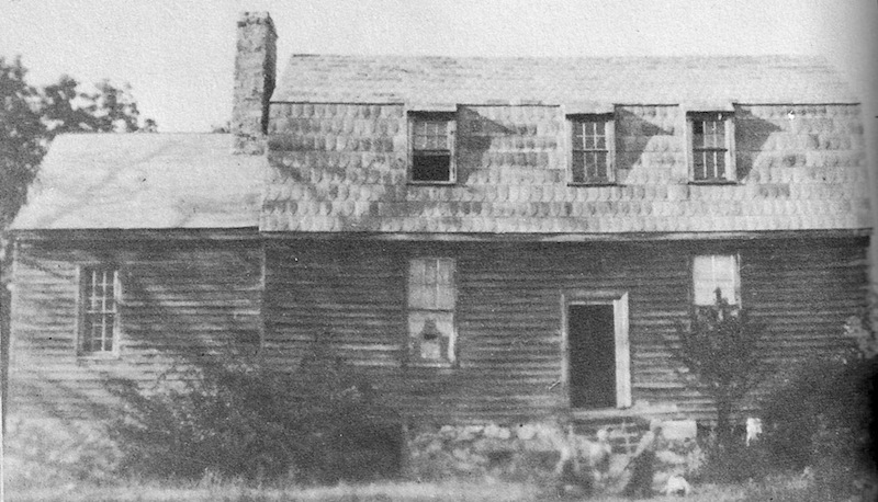
Patrick Robert "Parker" Sydnor Log Cabin
*National Register of Historic Places
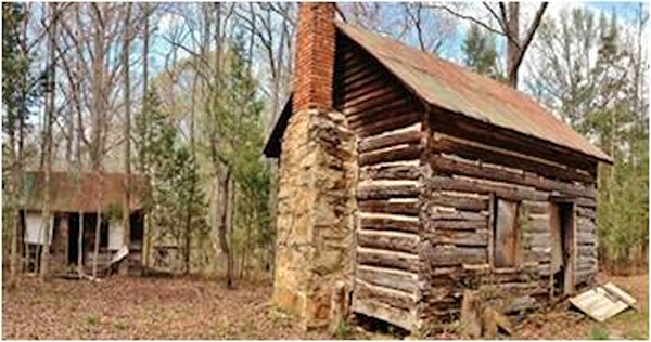
Near the intersection of Wilbourne Road and Morgan Farm Road (Routes 701 & 702); near Clarksville, VA
Hours:
Private site, currently not open to the public
The Patrick Robert "Parker" Sydnor Log Cabin is a tangible representation of the history of African American families in Mecklenburg County. After Reconstruction, Virginia had the highest percentage of freed African Americans who bought real estate and established themselves as small farmers on plots of land often adjacent to former plantations.
Hours:
Private site, currently not open to the public
(Read More, View Additional Photos)
Tanner's Store
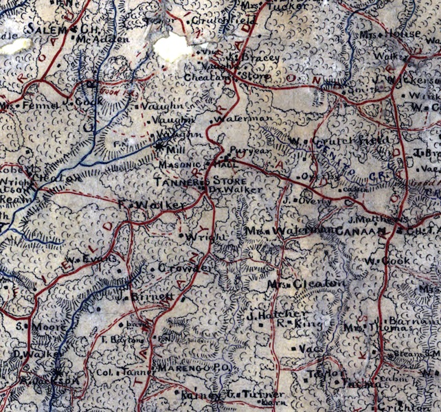
Site was northwest of Belfield Road and present day Marengo Road (formerly Saint Tammany Road) just south of La Crosse. Demolished.
For many years prior to and during the Civil War, Tanner's Store was owned by Evans Tanner (1796-1880s). The store, which also housed the Tanner's Store post office, was strategically located at the intersection of St. Tammany Road and Belfield Road, just south of present-day La Crosse. St. Tammany Road was the main north-south route in eastern Mecklenburg, at one point being the main road north to Petersburg but by the time of the Civil War it connected to the Boydton Plank Road, which had become the main route. Belfield Road was a major east-west stage road, connecting Boydton and Belfield (present-day Emporia).
(Read More)
Max Bagley Crowder Memorial Park at Whittle's Mill
Historic mill, picnic area, and canoe/kayak launch
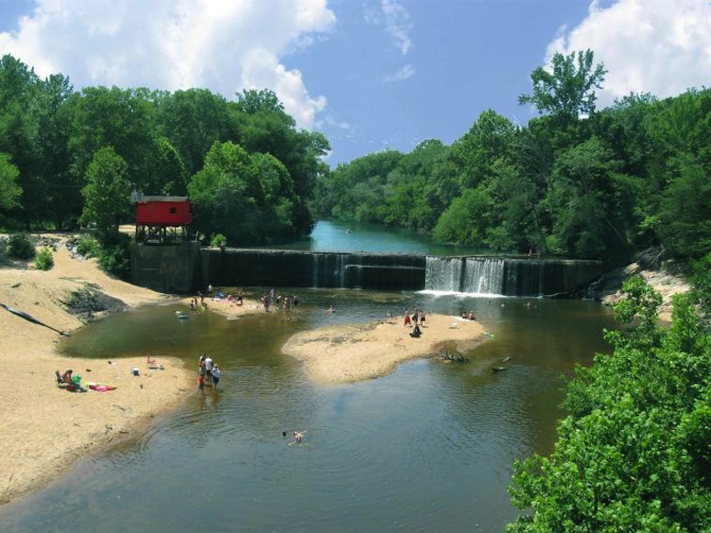
1793 Bridge Road, South Hill, VA 23970
(434) 447-3191 (South Hill Town Hall)
(434) 447-4547 (South Hill Visitor Center)
Hours:
Dawn to dusk; "primitive" tent camping is available after dusk to those who complete a camping reservation form at the South Hill Town Hall, located at 211 S Mecklenburg Ave., South Hill, VA. Only those with camping reservations are allowed in the park after dusk.
Fees: No fees for most activities; there is a $5.00 per night fee for camping.
Whittle's Mill is the site of a colonial era grist mill on the Meherrin River along the border of Mecklenburg and Lunenburg Counties. The park is among the loveliest small river sites in Southern Virginia, and the history of its namesake family is deeply entwined with the story of America. The scenic old millpond has been Southside Virginia's unofficial park for generations. The Town of South Hill has now made it official as the Max Bagley Crowder Memorial Park, honoring a distinguished Southside Virginia historian.
(434) 447-3191 (South Hill Town Hall)
(434) 447-4547 (South Hill Visitor Center)
Hours:
Dawn to dusk; "primitive" tent camping is available after dusk to those who complete a camping reservation form at the South Hill Town Hall, located at 211 S Mecklenburg Ave., South Hill, VA. Only those with camping reservations are allowed in the park after dusk.
Fees: No fees for most activities; there is a $5.00 per night fee for camping.
(Read More, View Additional Photos)
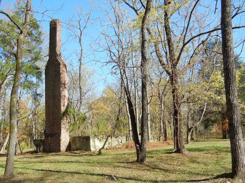
Woburn Plantation Manor House Remains, Burwell Family Cemetery, & Nearby Site of Former Woburn Winery
Hours:
Private properties not open to the public.
Locations: The Woburn Plantation Manor House Remains & Burwell Cemetery are in the vicinity of coordinates 36.542702, -78.463798, accessible via a gravel road that intersects with Ivy Hill Road just south of the Virginia/North Carolina line; the manor house remains include a foundation and chimney, to the east of the gravel road and the Burwell Cemetery to the west.
Former Woburn Winery's site is in the vicinity of 1516 Ivy Hill Road, Clarksville, Virginia. [map]
Woburn Plantation, originally home to Armistead Burwell (1770-1820) and his wife, Lucy Crawley Burwell (1775-1825), was completed circa 1799. The related Woburn property eventually totaled over 1,000 acres in the fertile lowlands of Island Creek. Craftsmen Jacob Shelor (after 1753-around 1840), a stone mason, and John Inge (1748-1820), a carpenter, were employed to build the house.
(Read More, View Additional Photos)
(c) Copyright 2014. All Rights Reserved. Designed by Jason Winter ||